

Beginning in 2020, RIDE Solutions began to create Self-Guided Bicycle Tours around the region as a way to enable people to become more comfortable with bicycling, and to learn about new bike routes they can use, particularly between their home and a destination they are trying to reach. Many of these self-guided tours had been created in the Roanoke area, but there were two created in the West Piedmont Region that had been identified for western Franklin County; they are entitled “Scenic Views – Dillon Mill/Adney Gap” and “Scenic Views – Wades Gap Road.” Please see https://ridewithgps.com/routes/34775545 and https://ridewithgps.com/routes/34775492 for more detailed information about these routes. This year, I have been biking in this beautiful spring weather, am working to identify additional bike tours, and the one I’m writing about today is located in Patrick County. Specifically, the route I’m recommending today is referred to as “Scenic Views – Patrick Springs to Stuart,” and serves as a fantastic ride characterized by beautiful country scenery at every turn, very low traffic volumes on most roads, and rolling hills that are very manageable for most bicyclists. RIDE Solutions’ direct link to this route can be found at https://ridewithgps.com/routes/36103171. This route, along with the two others mentioned above, are included within the Ride with GPS app, which you can download to your device before you ride!
The most direct route between Patrick Springs and the Town of Stuart is, of course, U.S. Route 58 – a distance of just over 4 miles from its vicinity in Patrick Springs to East Blue Ridge Street in Stuart. However, the very attributes that make this arterial roadway very efficient for high-speed travel between these two population centers may also make it very uncomfortable and intimidating for many cyclists. For those wishing to bicycle between Patrick Springs and Stuart, I would like to present an alternate route that, while not quite as direct, will almost certainly be more enjoyable.
For this ride, I started out at Patrick Springs Park, located just off of Mt View Loop, intersecting Spring Road. From there, I rode from Patrick Springs Park about 0.3 miles south to U.S. Route 58. I crossed U.S. Route 58 and proceeded southbound onto South Mayo Road. South Mayo Road is characterized by nice views, low traffic volumes, and mild topography (few hills). I took South Mayo Road for 1.1 miles to its intersection with New Hope Church Road.
I turned right onto New Hope Church Road, which will generally lead you in a westerly direction. The topography of this road is downhill early on, after which it passes over a scenic brook. It then continues uphill, and then transitions downhill before intersecting with Poplar Road. The South Mayo River runs parallel to about the last half-mile of New Hope Church Road road before you arrive at the intersection of Poplar Road, making for an enjoyably scenic experience. The total distance on New Hope Church Road is just shy of 2 miles (about 1.94 miles).
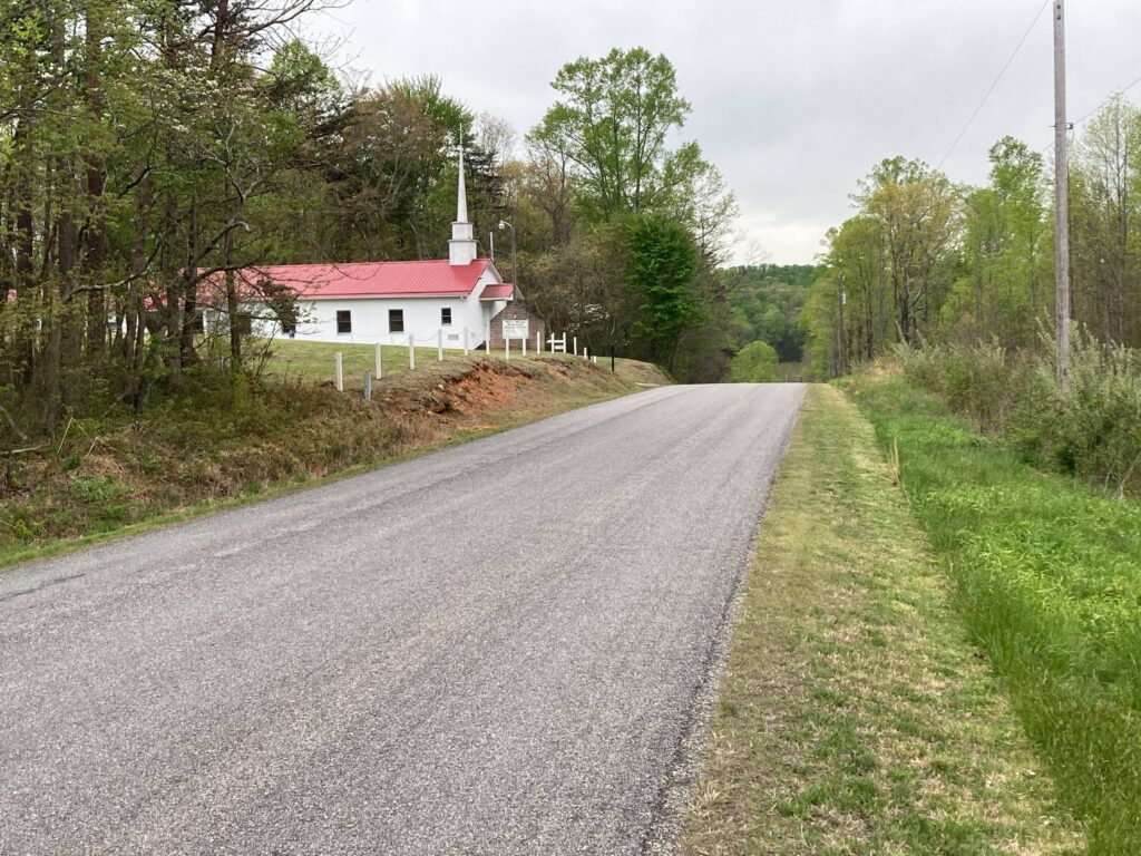
Church along New Hope Church Road.
I then turned left on Poplar Road, which offers a beautiful overview of the South Mayo River which passes underneath it. I rode Poplar Road for a very short distance – about 0.1-mile before turning right onto Commerce Street. Of the roads I had biked on to this point, Poplar Road had a somewhat higher traffic volume. Because of the higher traffic volume in conjunction with at least two intersections within close proximity of each other, as well as some sight restrictions, I would advise you to stay alert.
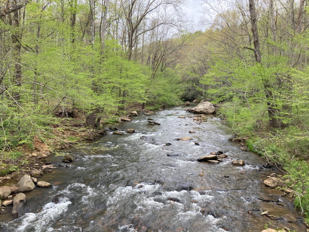
The South Mayo River passing under Poplar Drive.
The ride on Commerce Street is very pleasant and, like many of the aforementioned roads, this one is characterized by very low traffic volumes, a few very manageable hills, and excellent scenery. Commerce Street brings you into the Town of Stuart, so expect to experience somewhat higher traffic volumes as you approach the town. Once you pass Woodland Drive on your right, look to your left and you will see the Mayo River Rail Trail intersecting Commerce Street about opposite Developmental Road. The Mayo River Rail Trail runs generally parallel to Commerce Street to the vicinity of its intersection with Patrick Avenue near Downtown Stuart. This trail is a great alternative to Commerce Street, as the increasing traffic levels and lack of shoulder space may create an environment that is intimidating to cyclists. The total distance on Commerce Street is approximately 2.6 miles, about 0.65 of which comprises the Mayo River Rail Trail, and the remainder comprising Commerce Street itself.
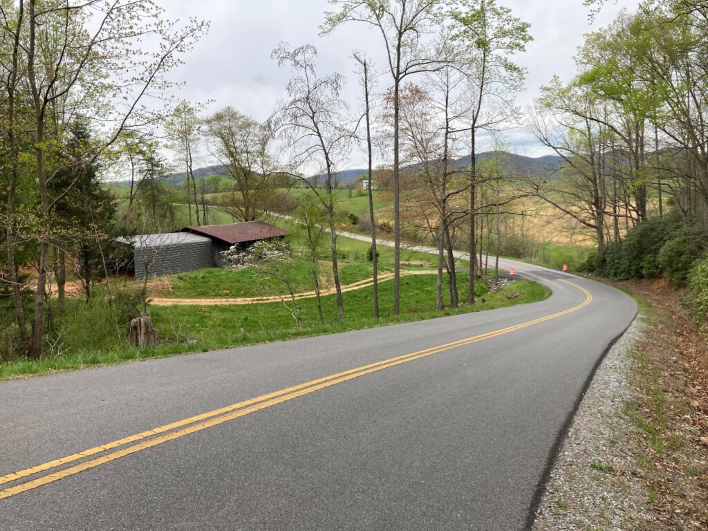
Commerce Street approaching the Town of Stuart.
Once I arrived at the intersection of Commerce Street and Patrick Avenue, I turned right onto Patrick Avenue. Patrick Avenue takes you past the variety of establishments comprising Downtown Stuart (mostly on your left), and the Stuart Farmers’ Market will be up the hill on your right (the Farmers’ Market is open Fridays from 8 a.m. to noon, and would be a great place to stop for a break). Once past most of downtown Stuart, I turned left on a small crossover road onto South Main Street and turned right, proceeding to the intersection of North Main Street. The total distance on the Patrick Avenue and South Main Street segment is about 0.3-mile.
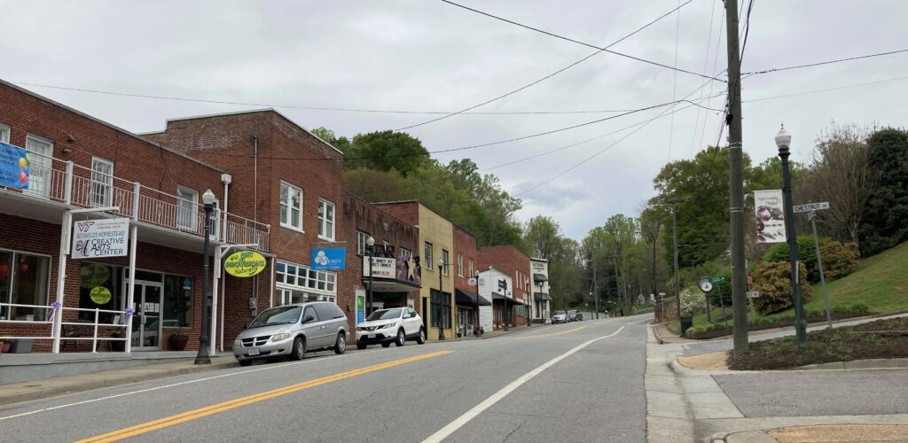
Businesses along Patrick Avenue, Downtown Stuart.
At this point, I turned right onto North Main Street, and this street serves as the commercial and civic heart of the Town of Stuart, home to numerous retail and dining establishments, the courthouse, and a post office. After riding approximately 6 miles from Patrick Springs, you may want to stop in town for a rest, to have lunch at one of the many dining establishments along North Main Street, and maybe to explore some of the shops. The total distance along North Main Street is about 0.2-mile.
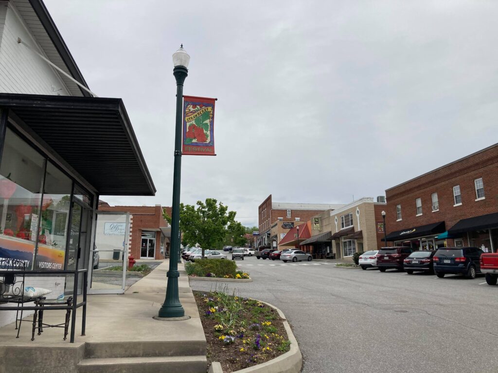
Stuart’s commercial center, along North Main Street.
After I stopped to rest for a while and to get some lunch, I proceeded on my way. At the top of North Main Street, I turned right onto East Blue Ridge Street, some of which has shoulder space. Like Commerce Street in town, Blue Ridge Street is characterized by a somewhat higher level of traffic than many of the more rural roads I’ve described in this blog, so some caution is advised, though the traffic is not overwhelming. East Blue Ridge Street intersects with U.S. Route 58, but I turned right onto Glenwood Terrace Loop prior to this intersection, which runs parallel to U.S. Route 58 for about 0.26-mile. Keep in mind that this portion of U.S. Route 58 does not have a shoulder, so Glenwood Terrace Loop is an excellent alternative. The total distance on the road pair consisting of East Blue Ridge Street and Glenwood Terrace Loop is about 1 mile.
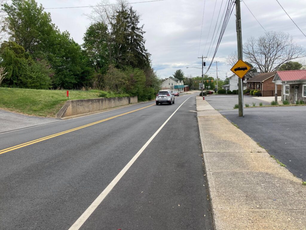
East Blue Ridge Street, Stuart.
Glenwood Terrace Loop intersects with U.S. Route 58, and I turned right onto 58. While this section of U.S. Route 58 is fairly busy with traffic and there is no shoulder present, I was only on this arterial for less than 0.1-mile. At this point, I turned left onto Rhody Creek Loop which, as is the case with Glenwood Terrace Loop, generally parallels U.S. Route 58 for a distance of about 0.85-mile. Rhody Creek Loop is characterized by moderate and very manageable topography, and very little traffic.
Being a loop road, Rhody Creek Loop once again intersects with U.S. Route 58 in the vicinity of the Wal-Mart shopping center. At this point, I turned left (east) onto U.S. Route 58; this section of 58 is served by an ample shoulder, but on the eastbound side of the road only. I rode on this segment of Route 58 for about 0.65-mile until I arrived at the intersection of Animal Clinic Road, located on my left. While U.S. Route 58 is characterized by a much greater volume of traffic than all of the other roads I bicycled, the wide eastbound shoulder provides comfort and makes riding on this road far less intimidating than it otherwise would be.
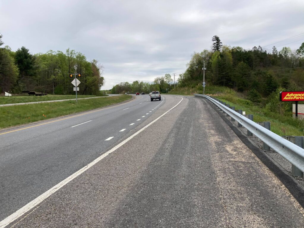
Ample shoulder along U.S. Route 58 East.
At this point, I was ready to return to Patrick Springs, so I turned left onto Animal Clinic Road. Like many of the other roads located throughout the very rural portions of Patrick County, Animal Clinic Road is likewise very quiet, with low traffic volumes. I biked Animal Clinic Road for about 1.5 miles, and once Animal Clinic Road crosses Tudor Orchard Road, it becomes Providence Road. I continued eastbound on Providence Road for another 1.1 mile, at which point it intersects with Spring Road in Patrick Springs.
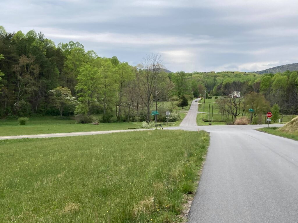
Animal Clinic Road and Providence Road.
At this point, I turned right onto Spring Road to return to my starting point, Patrick Springs Park, which is located about 0.6-mile to the south of the intersection of Spring Road and Providence Road. If you ride on Spring Road, be aware that this road accommodates higher traffic volumes than many of the other rural roads found in Patrick County, so use caution in that regard. The full mileage of the Patrick Springs to Stuart loop is about 12.3 miles roundtrip.
The ride along this entire route is generally very pleasurable, but one thing I need to mention is the fact that residents of this area do not always keep their dogs on their property, and there were two instances in which I was chased by dogs while riding. Be mindful of this as you ride, and you may even want to consider bringing a can of dog repellent with you.
You can ride either way on this loop, but I chose to ride from Patrick Springs to Stuart. If you ride from Patrick Springs to Stuart in the opposite direction, keep in mind that U.S. Route 58 does not have a shoulder in the westbound lane at this time. Additionally, you may want to consider just riding the southern part of the loop both ways, which includes South Mayo Road, New Hope Church Road, Poplar Road, Commerce Street, Patrick Avenue, and South Main Street to North Main Street.
If you are riding this route, or a portion thereof, as a means to travel to either Stuart or Patrick Springs to access a destination such as work, shopping, doctor appointment, etc., don’t forget to log your trip in the RIDE Solutions app to earn points toward great rewards! This app is available to download for FREE at ridesolutions.org.