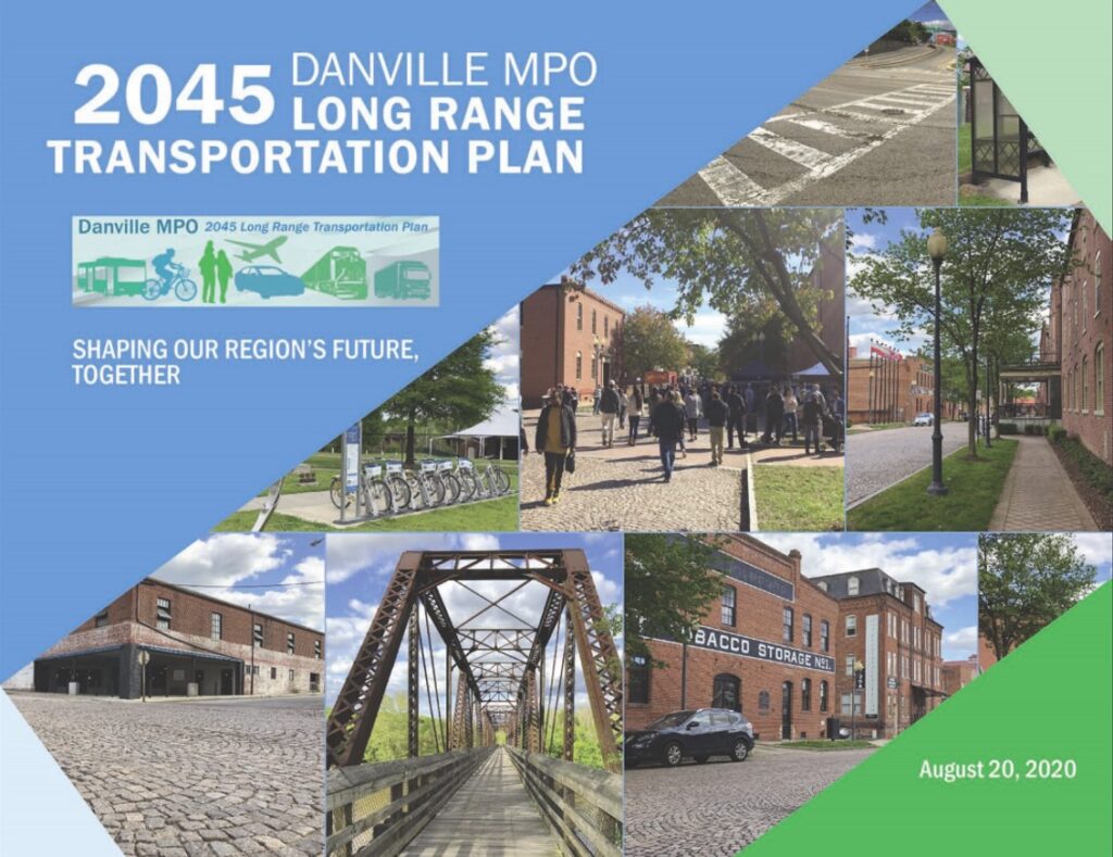
On August 20th, the Policy Board of the Danville Metropolitan Planning Organization (MPO) adopted the Danville MPO 2045 Long Range Transportation Plan. This plan, an update of the 2040 plan, presents recommended transportation investments in the MPO’s jurisdiction to the year 2045, which includes the City of Danville and the adjoining portion of Pittsylvania County. An MPO is an urbanized area of a county or region, for which transportation planning takes place at the metropolitan level. Development of a long range transportation plan on a five-year basis is an essential part of the metropolitan transportation planning process, and is a prerequisite for the receipt of federal funds for transportation projects.
The heart of the Long Range Transportation Plan consists of two documents: the Constrained Plan and the Vision Plan. The Constrained Plan is a compendium of identified transportation priorities that are anticipated to be funded out to the horizon year of the plan, which is 2045, based on projected funding levels. The Vision list is comprised of those projects which have been identified, but which lack any firm funding sources.
In addition to the Constrained and Vision portions of the plan, other relevant sections include a report on the state of the transportation system, demographic and land use trends, goals and performance measures, a summary of the process employed to determine transportation priority projects, and transportation priority areas.
In contrast to the 2040 Long Range Transportation Plan, the 2045 plan places much greater emphasis on alternative modes of transportation. For instance, Chapter 5, “State of the System,” contains a large section articulating elements of a Regional Concept of Emerging Mobility (RCEM), which offers guidance for the creation of a more holistic, integrated, and user-friendly transportation system for the Danville and Pittsylvania County region, as well as for best utilizing existing resources to maximize functionality of the transportation system. These RCEM elements were conceived from a workshop pertaining to the integration of emerging mobility with the existing transportation system, which was hosted by the Federal Highway Administration (FHWA) in March. Furthermore, Chapter 8, “Transportation Priority Areas,” includes a section about complete streets, including practical applications of this mobility paradigm in the MPO area, along with possible street reconfigurations.
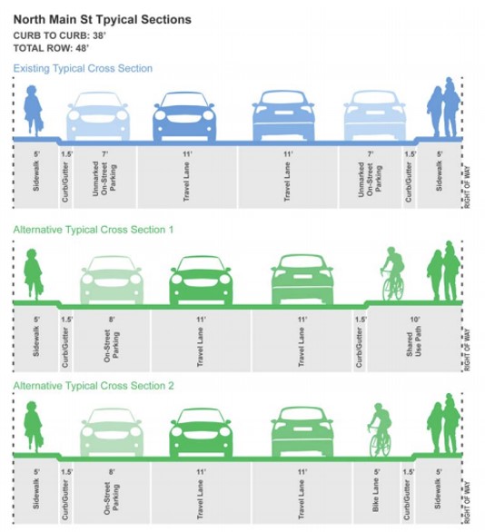
An example of possible complete street configuration for North Main Street in Danville, within the Danville MPO Long Range Transportation Plan.
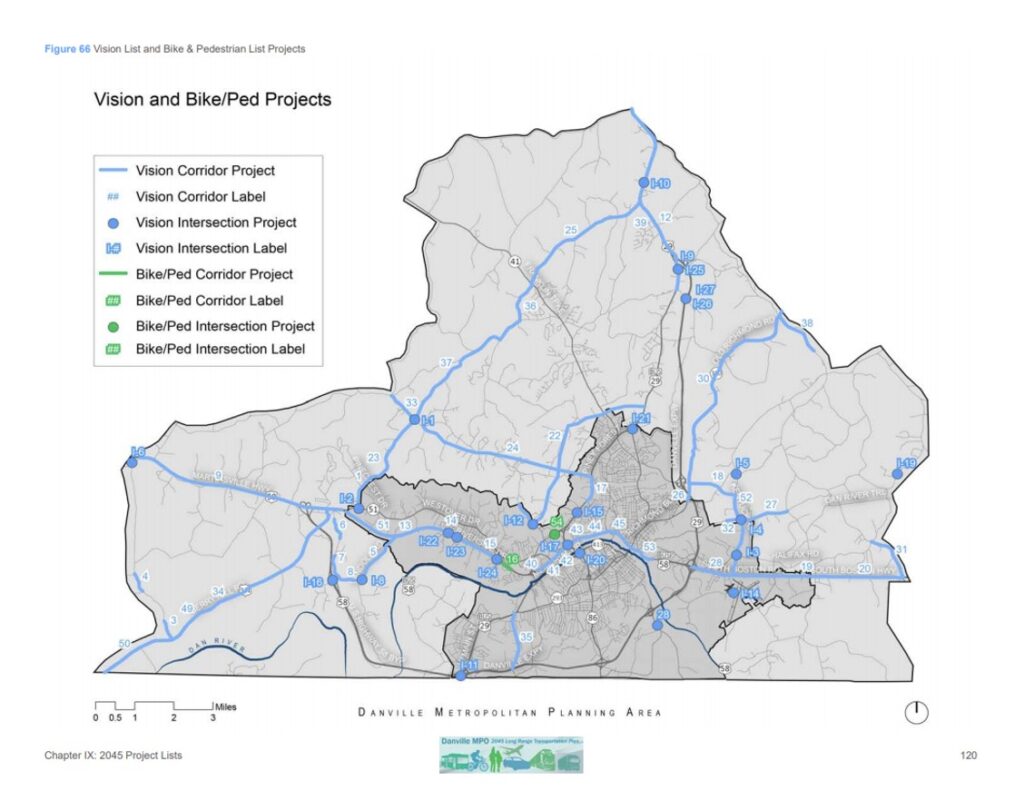
Specific project recommendations, included in Chapter 9, still emphasize road projects, but have more of a multimodal focus than the 2040 plan. For example, the updated plan includes multiple references to improvements along Riverside Drive (U.S. Route 58 Business) in Danville, sourced from the Riverside Drive (US 58 Business) Corridor Improvement Study, which recommends construction of sidewalks and intersection improvements on most segments. A brief list of bike/pedestrian projects is also included in Chapter 9. This list features a connector trail linking the Danville Riverwalk Trail with the Ringgold Depot Trail, which would create a continuous multi-use facility approximately 20 miles in length. This list also includes a proposed multi-use path along an approximate 0.5-mile length of Riverside Drive between Barrett Street and Radio Lane in Danville, as well as the recommendation for the construction of 2.25 miles of sidewalk along Piedmont Drive and adjoining streets in northwest Danville to promote a more multimodal transportation system in this very auto-centric shopping district.
In addition to active transportation infrastructure, Chapter 9 includes a separate table for transit improvements. Some of these recommendations include “Consolidate the Schedules of Duplicative Routes,” “Install New and Improve Existing Bus Stop Amenities,” and “Bus Installation of Bicycle Racks on Buses,” among other recommendations.
Lastly, in contrast to the 2040 plan, this updated plan includes recommendations featuring innovative intersections such as roundabouts and Restricted Crossing U-Turns (R-CUTS). Roundabouts are familiar to most everyone, and they promote intersection safety by forcing traffic to slow down while approaching an intersection and reducing the number of vehicular conflict points significantly compared to traditional intersections. Roundabouts also accommodate pedestrians more safely than many traditional intersection designs because their raised medians serve as pedestrian refuges, and they improve roadway function by keeping traffic moving. R-CUTS are designed to keep traffic moving on major roadways, while generally rendering intersections safer than traditional configurations. R-CUTS accomplish this by prohibiting vehicles from turning left from minor (side street) approaches, and instead require all traffic entering the major road from side streets to turn right; those drivers wishing to turn left would make a U-Turn at a designated location just to the right of the intersection.
You can learn more about the Danville MPO 2045 Long Range Transportation Plan, and its recommendations by visiting http://www.wppdc.org/content/wppdc/uploads/PDF/danville_lrtp_final_draft_091620_sm.pdf.