

On Tuesday, October 5th, Franklin County held a public input meeting as part of its update to the Union Hall Village Plan, adopted in March, 2014. The purpose of the meeting was to inform the County’s residents and stakeholders with regard to this process and to solicit input for the new plan. The meeting, which took place at a local church in the area, was very well-attended, and if I were to estimate, I would say that well over one hundred people were in attendance.
For those not familiar with Franklin County, Union Hall is located in the eastern portion of the County, generally in the vicinity of Route 40 and Kemp Ford Road (Route 945). Development in the area is relatively sparse and consists of small establishments such as a couple of banks, a gas station, a post office, and several independently-owned businesses. A few residences are located in the area, and much of the remaining land use remains agricultural.
The purpose of the plan update is to serve as a portion of the County’s comprehensive plan to guide future growth in Union Hall. Funding for this update was awarded to the County via a GAP (Growth and Accessibility Planning) grant, through Virginia’s Office of Intermodal Planning and Investment (OIPI), and the update is a 12-month process currently in its infancy. The lead consultant for this project is EPR, PC, of Charlottesville, which has worked with the West Piedmont Planning District Commission (WPPDC) and Danville Metropolitan Planning Organization (MPO) in the capacity of developing numerous studies, for several years. One possible reason for the County choosing to pursue the grant funding to update this plan was the advent of Smart Scale, which revolutionized transportation funding in the State to be based on a variety of performance criteria such as how projects would likely improve accessibility, reduce congestion, improve safety, lead to reduced environmental impact, and promote economic development. Projects in urban development areas (UDAs) which generally favor those pertaining to pedestrian and bicycle infrastructure, are also eligible for this funding stream, and the plan update may have been necessary to maximize consistency with Smart Scale. Furthermore, the current plan is mostly focused on transportation improvements, whereas the updated plan will likely incorporate other aspects of planning such as zoning recommendations, housing suggestions, and agricultural land and scenic viewshed preservation strategies, among others.
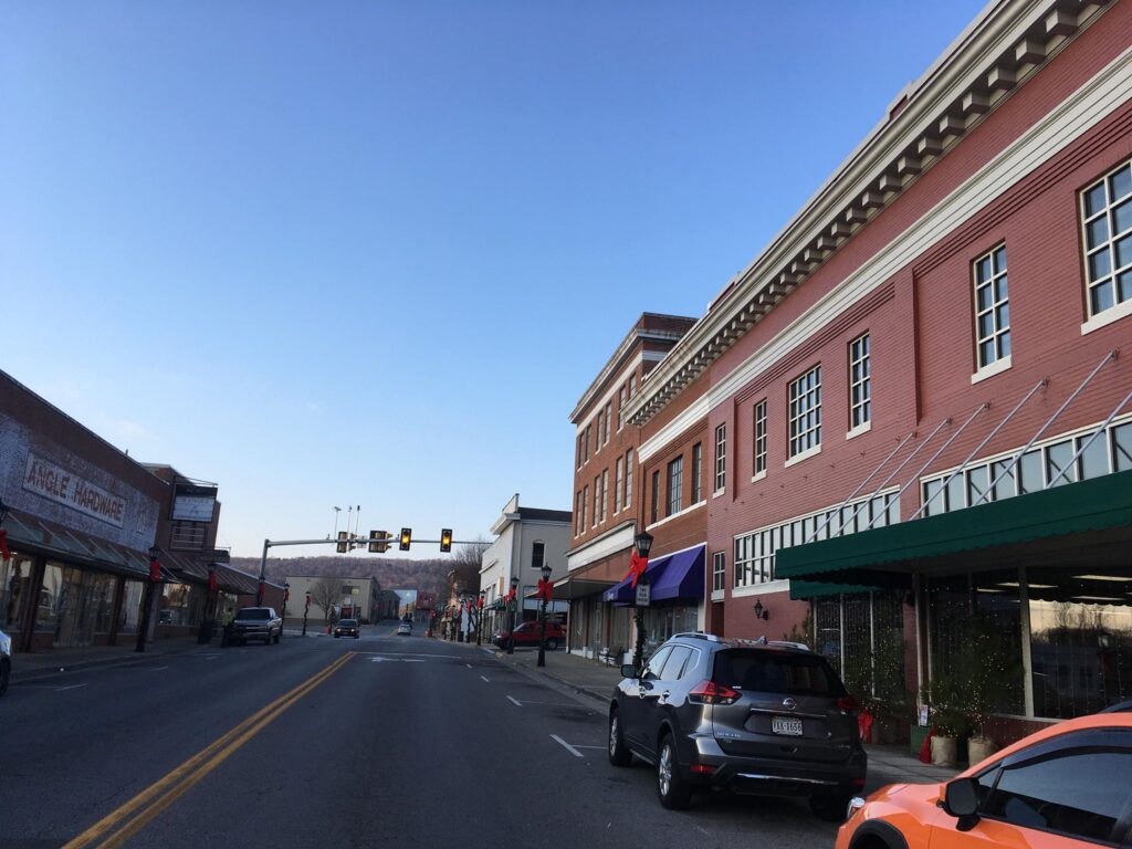
Downtown Rocky Mount, which is situated in an Urban Development Area (UDA), accommodates multiple modes of transportation.
The meeting included a number of display boards set up for the public to view, which articulated existing conditions in the area, recommendations advanced via the 2014 plan, and other information. Attendees also had the opportunity to speak with County and EPR staff regarding aspects of the plan update process. Following this, EPR delivered a presentation which included much of the material spoken of within this paragraph, as well as an introduction to the plan update process. The plan, once complete, will serve as a blueprint for a new development pattern for the Union Hall community in the form of a village setting along with a multi-modal transportation system. During the meeting, it was noted that among the mechanisms the plan would advance in developing a village setting would be new zoning designations, transportation infrastructure recommendations to support village-type growth, and a recommendation for a variety of housing types to support individuals and families of a diversity of financial means.
Several points of discussion emerged following the presentation. It was noted that property along the southern end of the proposed village, south of Route 40, is planned to be developed as a shopping center. Potential water sources for the new village was a point of discussion, since residences and businesses are currently served by well and septic. The current transportation network was noted as a limitation to future development, as one attendee noted that traffic would only get worse if development occurred and the transportation infrastructure was not improved. Lastly, it was stated that land owned by Appalachian Power (AEP) and located northeast of the Union Hall area and adjacent to Smith Mountain Lake was planned to be auctioned off in the near future.
Some of the major features in the current Union Hall Village Plan, adopted in 2014, include the following:
- Roadway interconnectivity. This refers to a road pattern common to the way villages and cities were developed years ago, relying on more a “grid” system which facilitates more than one route of travel to enhance connectivity within various areas of population centers. Currently, Kemp Ford Road funnels much of the traffic to and from the section of the Smith Mountain Lake community located immediately north of the Union Hall area.
- New roadway intersections to serve as activity nodes. The current plan advances the recommendation that intersections throughout the village should serve as activity nodes characterized by denser development than their surrounding areas, with a variety of uses to promote multimodal transportation.
- The plan also describes the characteristics of four different settlement areas common to the village environment, notably the Village Center, Neighborhood Center, Neighborhood, and Rural Cluster. Additionally, the plan includes a table of road characteristics for each of the four distinct settlement areas, such as speed limit, lane widths, number of travel lanes, and dimensions of bike lanes, among other technical criteria.
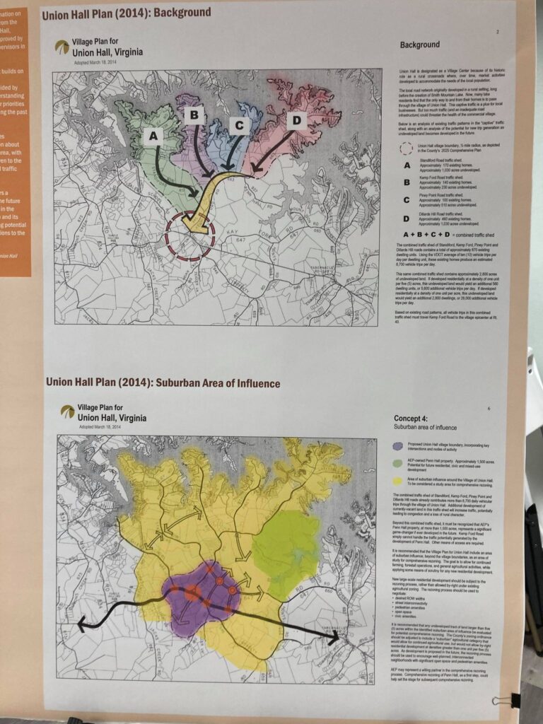
A display board at the Union Hall Village Plan public meeting on October 5 showing recommendations from the 2014 plan.
Franklin County has posted information about this new Union Hall Village planning initiative on its website, which includes the presentation from the meeting, as well as a survey that Union Hall area residents are encouraged to fill out and submit digitally by October 31st. The 2014 Union Hall Village Plan can be accessed at https://www.franklincountyva.gov/340/Union-Hall-Area-Plan, and the online survey is available at https://www.surveymonkey.com/r/UnionHall2021, and is also available on the main website.
Whether you live in Martinsville, Danville, Stuart, or Union Hall and you carpool or telework as part of your daily commute, or you use transit, walk, or bike for your essential trips or as part of your commute, don’t forget to log each trip in the RIDE Solutions app to earn points toward discounts for each trip you take! Remember, if only part of your trip consists of a green component (walking, carpooling, transit, or biking) and you drive part of the way, you are eligible for the discounts. To learn more about the “drive alone” feature, please see my recent blog about this topic at https://ridesolutions.org/2021/10/05/ride-solutions-to-include-single-occupancy-vehicle-trips-for-commutes-other-local-trips/. To download the RIDE Solutions app, which is no cost to download or operate, simply navigate to https://ridesolutions.org/.