

With the weather warming up, many of us are looking to find great ways to spend time outdoors in order to stay in shape. Biking is a great way to stay in shape, in addition to being a lot of fun and a great de-stressor! In this blog, I will write about some of the places I enjoy biking most in the region. I will also touch on a great resource, the West Piedmont Regional Bicycle Plan, to help you make the best choices about where to ride most comfortably.
Our region, the West Piedmont Planning District, comprising Franklin, Henry, Patrick, and Pittsylvania counties, the Cities of Danville and Martinsville, and the Town of Rocky Mount, is generally rural, and interspersed by a number of population centers. The western portion of our region is very mountainous, offering excellent views of the landscape. It is these qualities of our region which make it a great place to ride!
Danville
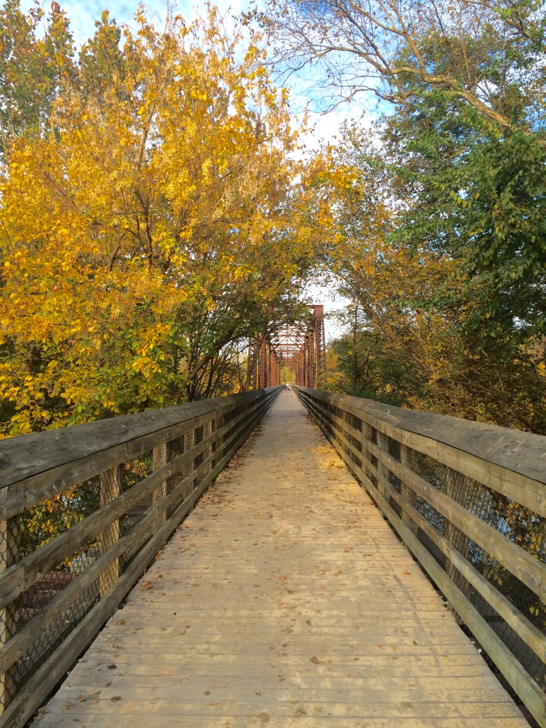
The City of Danville is a great place to ride, due, in large part, to the beautiful Danville Riverwalk Trail, which extends from Stinson Drive near Danville Regional Airport west along the Dan River to the Robertson Bridge (Piedmont Drive). The trail passes through two recreational crown jewels in the city, Dan Daniel Memorial Park and Anglers Park. From Anglers Park west, the trail is generally level and offers the rider multiple opportunities to connect to Danville’s thriving River District. Additionally, the trail offers great views of the Dan River at every turn. So if you live or work in the City of Danville or are just visiting, the Riverwalk Trail is a great option to have some recreational fun while getting a great workout! Since the trail connects to multiple parks and the River District, the Danville Riverwalk Trail is also a great mode of alternative travel.
Martinsville
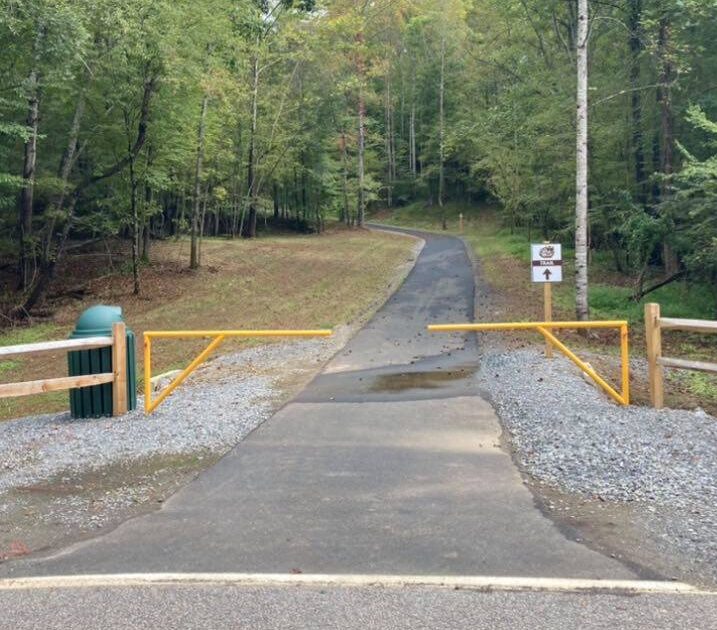
The Dick & Willie Trail in the City of Martinsville is a great recreational and transportation asset in the City. The original portion of the trail, constructed from its western terminus near Virginia Avenue and Wal-Mart, continues east for about 4.5 miles to Mulberry Creek.
More recently (in 2019) a second phase of this trail was constructed between Spruce Street and the Smith River Sports Complex in Henry County, a distance of about 2.7 miles. The original 4.5-mile section of the trail generally rises in elevation from west to east, and is great for a workout. This new 2.7-mile segment, however, is much more level (though there are some hills) and more conducive to a relaxing recreational ride. Furthermore, this portion of the trail parallels Mulberry Creek, and as you get closer to the Smith River Sports Complex, parallels the Smith River, offering beautiful scenery of the river. There are plans in place to link the two existing portions of the trail with a new trail in the near future.
Franklin County
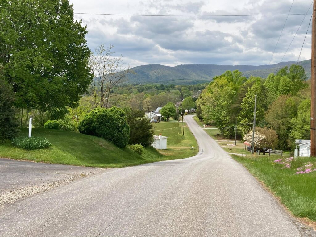
The western half of Franklin County is generally very rural and mountainous along its western border, while the eastern half, while also rural, is typified by greater amounts of traffic due to the presence of the Smith Mountain Lake community and inter-county connections with Bedford and Pittsylvania counties. One of the places I have really enjoyed bicycling is in a section of the western portion of the County, characterized by very low traffic volumes and outstanding scenery due to bucolic, pastoral views and mountains in the distance. In particular, one of my favorite places to ride has been Dillons Mill Road between Wades Gap Road and Adney Gap Road. You can continue on Adney Gap Road, however, it rises significantly in elevation after about 0.5-mile, making it a challenging ride. If you feel you are up for it, however, Adney Gap Road offers outstanding views!
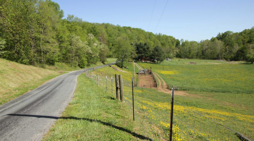
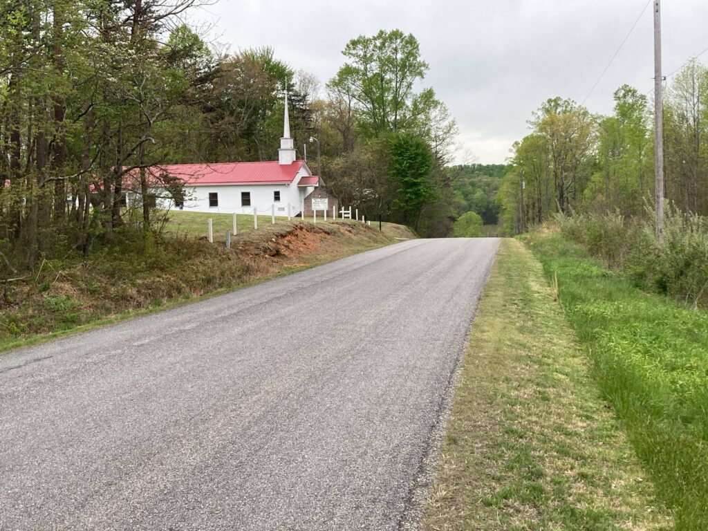
Wades Gap Road, which intersects Dillons Mill Road, is a great road to ride as well. Riding north from Dillons Mill Road is initially fairly level, for about the first 1.5 miles, but then it rises in elevation. That said, this road accommodates very little traffic, and the road is relatively narrow so that traffic generally cannot move very fast. Furthermore, about 1.5 miles north of its intersection with Dillons Mill Road is a great place to stop for a rest or a picnic. This stop consists of a church-owned property comprising a picnic shelter and a playground on the right side of the road (northbound), which is open to the public. If you are driving into this area to go biking and are looking for a place to park, cyclists are permitted to park at the Monte Vista Church, located at the intersection of Dillons Mill and Wades Gap Roads.
RIDE Solutions promotes these routes among its self-guided bicycle tours. To learn more about these routes, please visit https://ridewithgps.com/routes/34775545 and https://ridewithgps.com/routes/34775492. You are encouraged to download the Ride with GPS app on your smart phone to get the most out of this route.
Patrick County
Patrick County is similar to Franklin County in terms of its geography and land use. Like many parts of Franklin County, most of Patrick County is very rural, and is characterized by bucolic, agricultural landscapes. Mountains also border the western side of Patrick County, just as they do Franklin County. As is the case with the rural sections of Franklin County, traffic volumes tend to be relatively light throughout much of Patrick County. All of these factors make Patrick County a great place to ride.
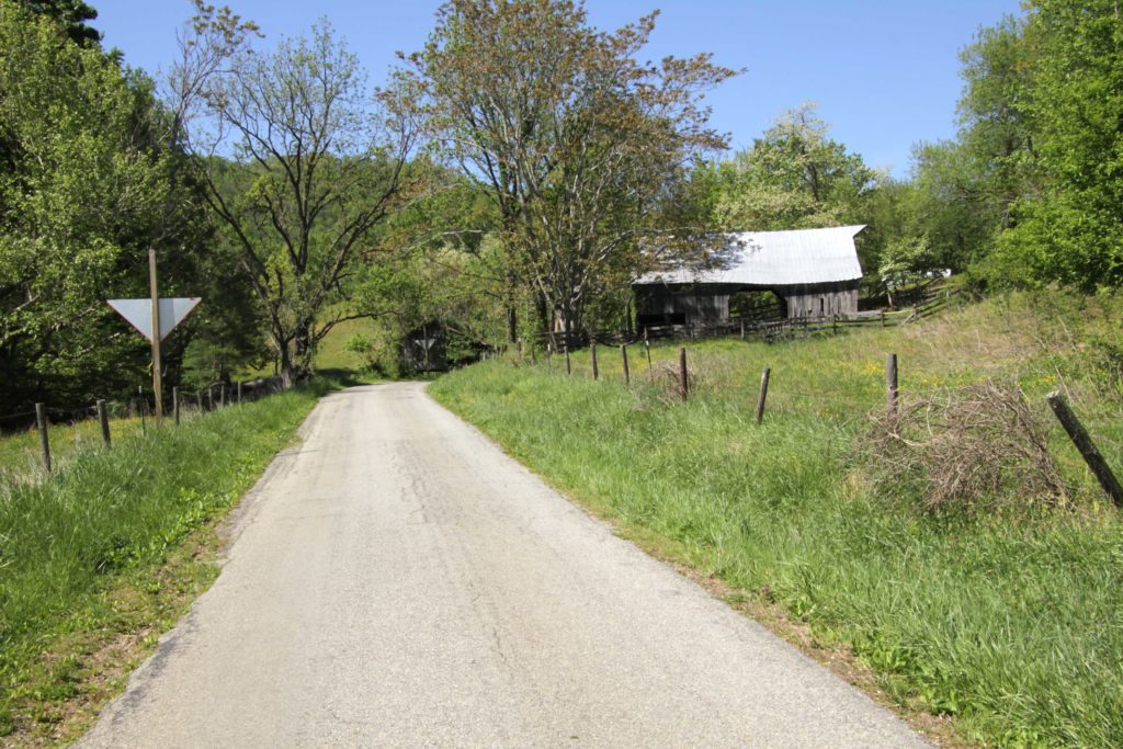
While Patrick County undoubtedly offers many great bicycling opportunities, I have found that Patrick Springs is a great place to start a ride, and I have begun rides at Patrick Springs Park. You may want to ride from Patrick Springs to Stuart or to Critz, and I had formulated two self-guided bicycle tours for the RIDE Solutions site, similar to those noted above under Franklin County. The ride from Patrick Springs to the Town of Stuart is about 5.5 miles by first riding south along South Mayo Drive from Patrick Springs Park, and then turning right on New Hope Church Road. New Hope Church Road passes over Anglin Branch, a scenic waterway; this road also parallels the South Mayo River, providing you with a lengthy view of this beautiful river. Next, you’ll turn left onto Poplar Drive, which passes directly over the South Mayo River, providing a great photo-worthy view of this river. You will next turn right onto Commerce Street, which provides pastoral, bucolic scenery. As you approach the Town of Stuart, you may want to transition to the Mayo River Rail Trail, as traffic on Commerce Street becomes a bit heavy as you get into town. Once in Stuart, you can stop at one of the many establishments in the uptown area, located along North Main Street, to have lunch before heading back. To learn more about this route, please see my blog entitled “Patrick Springs to Stuart Scenic Bicycle Tour” at https://ridesolutions.org/2021/05/26/patrick-springs-to-stuart-scenic-bicycle-tour/. Additionally, RIDE Solutions promotes this route as a self-guided bicycle tour, and you can learn about this ride (and you may want to download the Ride with GPS app for your smartphone) by visiting https://ridewithgps.com/routes/36103171.
Another great route, and one that is a bit shorter than the Patrick Springs to Stuart Scenic Bicycle Tour, consists of a ride from Patrick Springs east to Patrick County’s Critz community, where one can find the Reynolds Homestead, which is the former estate of tobacco magnate R.J. Reynolds, and is now a state historic site which also offers educational activities. Like the above ride from Patrick Springs to Stuart, I started out at Patrick Springs Park. From there, I rode Springs Road north and turned right onto Dogwood Road, which leads you directly to Critz – a distance of just over 4 miles. Like the ride from Patrick Springs to Stuart, this ride is scenic and comprises rolling hills, though it is not difficult to handle. Compared to the route from Patrick Springs to Stuart, Dogwood Road does have slightly more traffic, though, but not significantly more. If you choose to, you can make the return trip a bit more interesting by turning off of Dogwood Drive to Santa Claus Lane and to Scenic Drive, which will lead you back to Dogwood Road. Scenic Drive, however, is significantly more hilly, however, so take that into consideration. You may learn more about this scenic route by visiting my blog at https://ridesolutions.org/2021/05/27/patrick-springs-to-critz-bicycle-loop/, and information about the self-guided bike tour (for which you are encouraged to download the Ride with GPS app) is available at https://ridewithgps.com/routes/36176785.
Certainly there are far more routes in the region to ride than those which I have presented here, and Henry and Pittsylvania County offer additional great options. An indispensable resource for finding great routes is the West Piedmont Regional Bicycle Plan, which offers a great interactive map to help you find the ideal route to ride. This map is available at https://wppdc.maps.arcgis.com/apps/View/index.html?appid=abfe3df1b6ec4769aff2253d528fe2e9&extent=-80.3966,36.5503,-79.3420,37.0073, and a blog I recently wrote about this plan shows you how to use its many interactive features; this blog is available at https://ridesolutions.org/2021/06/09/plan-your-next-bicycle-trip-with-the-west-piedmont-regional-bicycle-plan/. One point of caution I would like to stress is that some people do not always keep their dogs tied up, and I had been chased by dogs a few times. If you are concerned about this, you may want to bring some dog repellant with you.
If you commute or travel for other essential trips by bicycle, or if you plan to as we approach summer, don’t forget to log your trips in the RIDE Solutions app, through which you will earn points toward great rewards for discounts on dining, shopping, entertainment, or chances to enter raffles to win great prizes! Simply download this FREE app today at ridesolutions.org!