

This past Saturday, I had the opportunity to take my bike to western Franklin County to enjoy all that this part of our region offers to bicyclists. During this era of social distancing, there are not many opportunities to get out, but fortunately bicycling is one of the exceptions. And if you ride primarily in urban environments, if you stick mostly to the trails, or you haven’t really thought of venturing into this part of the county for bicycling, perhaps you’d like to give it a try.
I’m familiar with this area in terms of bicycling, since a co-worker and I updated the West Piedmont Regional Bicycle Plan a couple of years ago, and scouted around this area identify new networks for the Plan (please see more information and the link for this plan below). There are several road segments I include in this blog as recommendations for great rides, and I list them each separately. These routes are characterized by very low traffic volumes, which contribute to rider comfort and enjoyment, as well as outstanding scenery. Many, if not most of you will be driving to the area to bike, and I would recommend the Monte Vista Church of the Brethren, located at the intersection of Dillons Mill Road and Wades Gap Road, as a place to park and start out on your ride; upon inquiring, the church’s Facebook administrator welcomed cyclists to park there, and noted that many already do during the week.
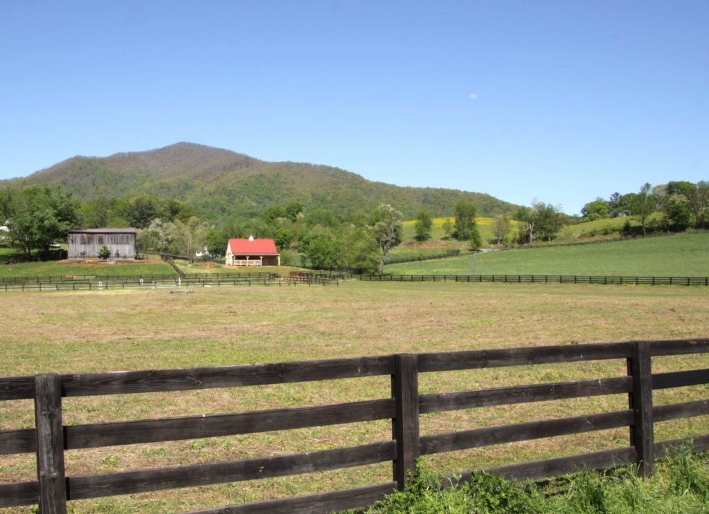
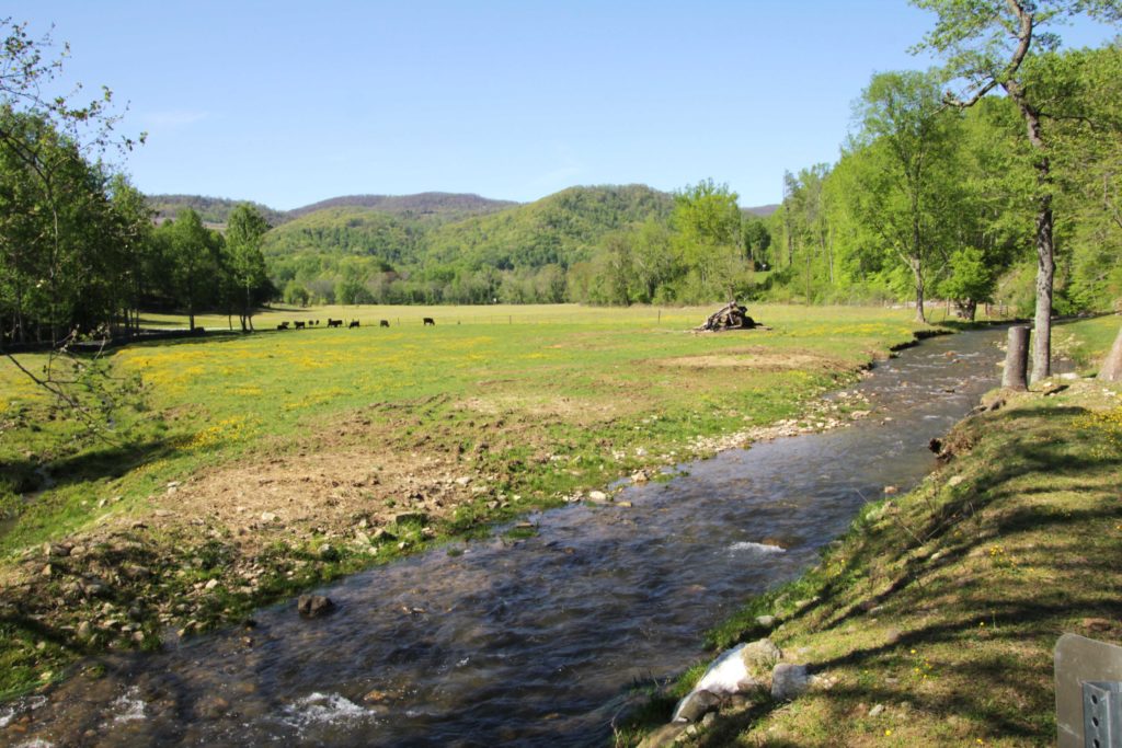
The first of these routes is Wades Gap Road, which extends from the intersection of Dillons Mill Road north to Naff Road – a total distance of about 5.6 miles. Departing from the southern end (at Dillons Mill Road), Wades Gap Road is fairly level, however it will be an uphill climb for a while beginning about 1.5 miles north of this intersection, after which the landscape becomes more subtle. About 1.4 miles north of Dillons Mill Road, I noticed a picnic shelter and children’s playground equipment, which appeared very welcoming, given the signage. Upon further investigation, I learned that Monte Vista Acres is owned by a local church and is indeed open to the public. If you’re out biking, this would be a great place to stop for a picnic or to admire the scenery while letting the kids play for a little while if you’re biking with the family. Likewise, Monte Vista Acres would be a great stop to rest and recharge if you’ve started on the Naff Road side. Even though it is open to the public, the site is privately owned, so please take out what you bring in, as I did not see any trash cans. The scenery along Wades Gap Road is outstanding and ranges from agricultural to mountainous, and you’ll even hear running water of numerous streams. Additionally, there is very little traffic on this road and any traffic generally does move slow which makes this ride so enjoyable, but of course always exercise caution while having fun. Furthermore, across the street from the church near the intersection with Dillons Mill Road will be two old structures. I cannot confirm, but I read that they were at once time a post office and a small store. Please see photos of the Wades Gap Road route below.
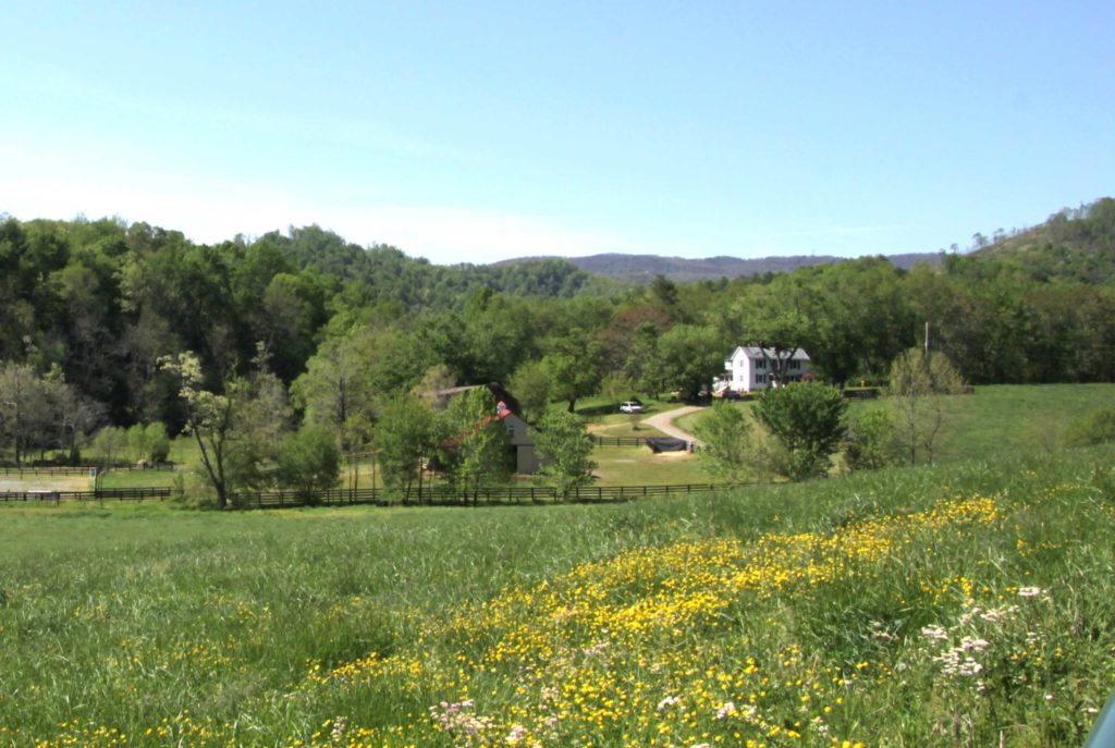
View of scenic landscapes from Wades Gap Road
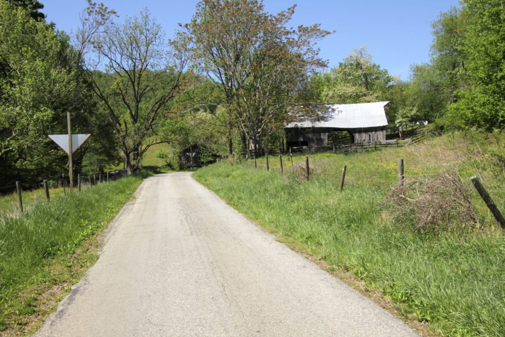
A view of an old barn along Wades Gap Road. This photo shows the typical narrow geometry of the road, making it conducive to slow traffic and low volumes.
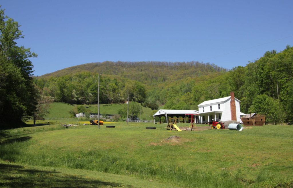
Monte Vista Acres, a peaceful wayside along Wades Gap Road which is open to the public and features a picnic shelter with picnic tables (in background) along with children’s playground equipment (foreground).
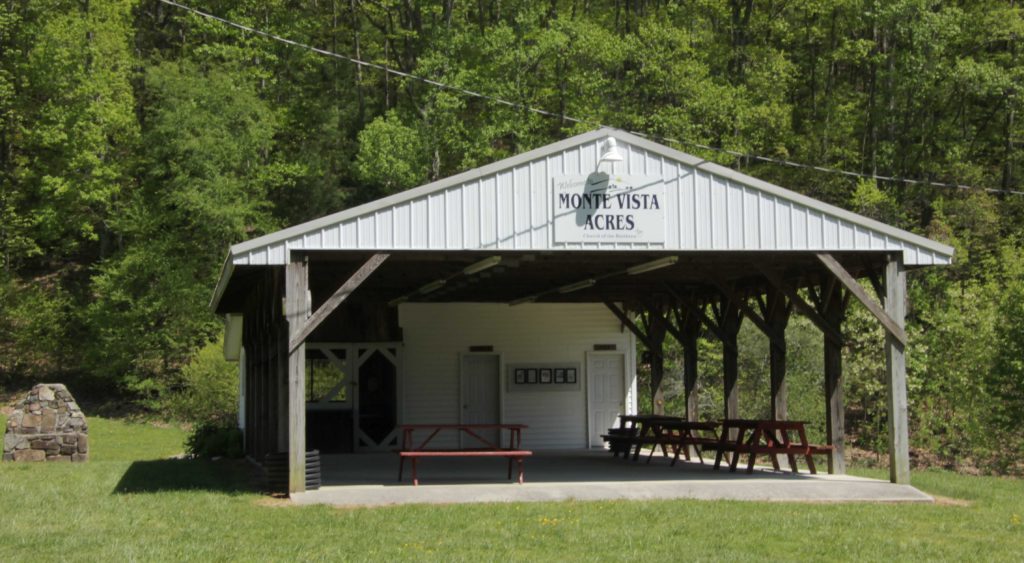
The picnic shelter at Monte Vista Acres, along Wades Gap Road. This makes a great “pit stop” for bicyclists to relax and have a picnic.
Another great route is Dillons Mill Road / Adney Gap Road. This road pair also makes for a great ride, but Adney Gap Road may be best suited for more experienced bicyclists, and I’ll explain why in a moment. Dillons Mill Road beginning at the intersection of Wades Gap Road and heading west is characterized by gentle elevation changes and beautiful views of farmland, mountains, and the North Fork of the Blackwater River. You’ll also see Fire Pink flowers growing on hillsides along the road; these distinctive red blossoms are native to much of the eastern U.S., but are not commonly seen, as they typically grow on rocky hillsides (photo below). Dillons Mill Road carries a greater volume of traffic than Wades Gap Road, but still a relatively small amount. Just shy of two miles west of Wades Gap Road, Dillons Mill Road intersects with Adney Gap Road, and there is a great location from which to view the river atop a bridge on Adney Gap Road. The first 0.5 mile of Adney Gap Road is paved and enjoyable for riders of most every skill level. After this, however, the road transitions to gravel and climbs in elevation. Cyclists continuing on Adney Gap Road should exercise caution, since there is a steep drop-off directly adjacent to the road, and there are some tight turns in spots, so it’s advisable to go slow so as not to be caught off guard by a vehicle coming around a curve. For these reasons and the narrow geometry of the road, there is very little traffic on this road, contributing to the comfort level of riding, however cyclists need to exercise caution while enjoying themselves. Adney Gap Road from the intersection of Dillons Mill Road to its terminus at Callaway Road is about 1.9 miles in length. Please see photos below of Dillons Mill Road and the northern part of Adney Gap Road.
Outstanding scenery from Dillons Mill Road.
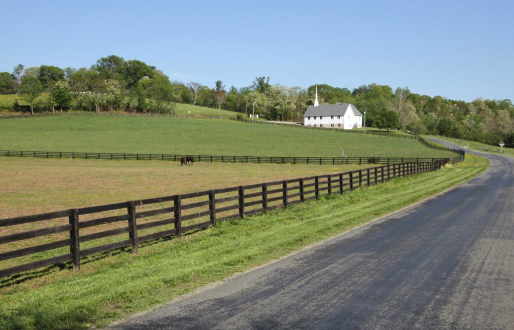
View of Dillons Mill Road looking east toward its intersection with Wades Gap Road. The church pictured here is a recommended place for cyclists to park if driving in.
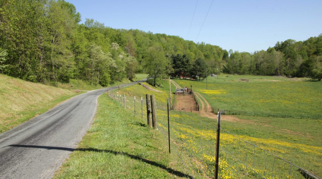
Agricultural scenery from Dillons Mill Road.
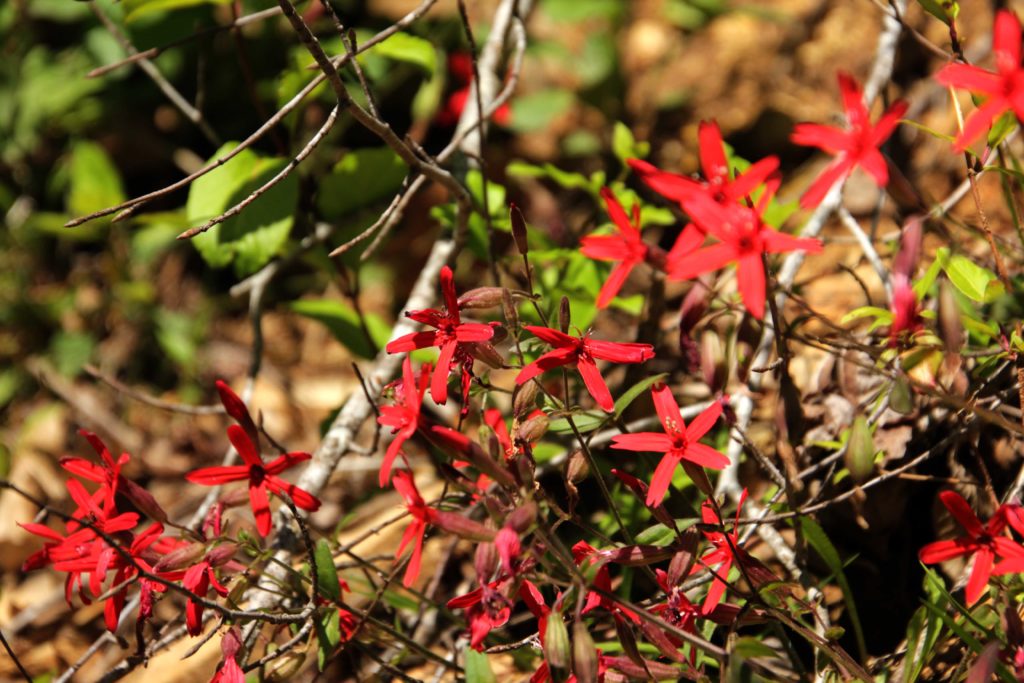
Fire Pinks, a distinctive red flower native to the eastern U.S. but not often seen, can be observed in multiple places along Dillons Mill Road.
The North Fork of the Blackwater River passes under a bridge on Adney Gap Road.
Webster Corner Loop. The last of the rides is a loop ride on Webster Corner Road. Webster Corner Road begins at Wades Gap Road about 1.3 miles north of its intersection with Dillons Mill Road, and forms a loop about 3 miles in length, ending at Dillons Mill Road south of the intersection with Wades Gap Road. Starting at the intersection of Wades Gap Road and Dillons Mill Road and cycling to either the Dillons Mill or Wades Gap intersections of Webster Corner Road and then riding a complete loop back to the starting point is about 5.3 miles in length. I biked about the first 0.75 miles of the loop, but looking at the map, the route appears to be continuous, although at least part of it appears to transition to gravel surface as it passes through a wooded area. The loop climbs in elevation, but is not extreme, and like many of the other roads, this one is characterized by very little traffic.
A great resource to help plan your trip is the West Piedmont Regional Bicycle Plan, developed as an update to the 2005 plan by the West Piedmont Planning District Commission and adopted in early 2018. The interactive map feature of this plan ( https://wppdc.maps.arcgis.com/apps/View/index.html?appid=abfe3df1b6ec4769aff2253d528fe2e9&extent=-80.3966,36.5503,-79.3420,37.0073 ) will provide you with valuable information for your ride such as recommended routes (green lines on the roads) and points of interest. If you click on a segment of a green line, a small menu will pop up which gives you information about the road, such as the road surface material; Annual Average Daily Traffic (AADT), which basically refers to average daily traffic volume (234, for example, means about 234 vehicles per day); and posted speed limit, where available. Points of interest are clickable as well. As a note, all of the routes noted in this blog are recommended routes in this plan with the exception of the Webster Corner Loop, as we were not aware of that opportunity at the time of the plan update.
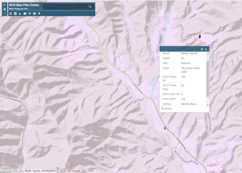
A screen shot of the West Piedmont Regional Bicycle Plan interactive map shows the information that is presented when a road segment or point of interest is selected.