The Roanoke Valley doesn’t have much severe traffic congestion – and we want to keep it that way! Take the survey here.
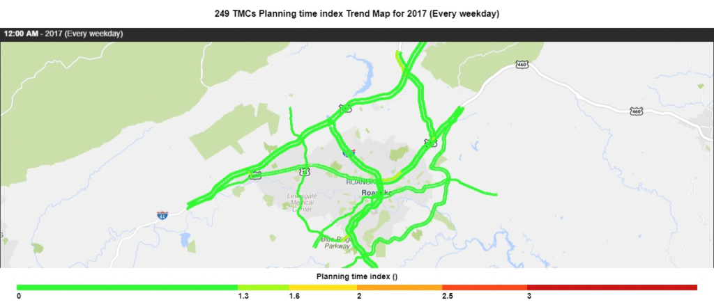
Modern technology has revolutionized our ability to define and objectively measure traffic congestion. Using “big data” collected from GPS-equipped vehicles and smart phone apps, we can literally see where traffic congestion occurs, how long it lasts, and how often. The traffic congestion metric that the Roanoke Valley uses is Planning Time Index.
Analysis of this data shows that the Roanoke Valley traffic congestion is not widespread, does not last a long time, and does not occur very often. Four corridors may be at risk of performing poorly:
- I-81 – State funding from the Interstate 81 Corridor Improvement Plan will improve safety and reliability.
- US460 – The Virginia Department of Transportation Route 460 Operational Improvement Study will identify ways to improve safety and traffic flow.
- Route 419/US 220 – Funded projects to provide adaptive signals and a diverging diamond interchange will improve traffic flow.
- Main St (Salem) – Main St is the center of Salem’s Downtown Plan.
Another corridor that may be at risk is Gus Nicks Boulevard / Washington Avenue, but travel time data is not available.
Outreach
Input from locality staff, freight logistics managers, and the public guides this update.
- Locality staff attended a Congestion Workshop on November 6, 2019.
- The Land Use focus group discussed how local government can guide or nudge land use through the permitting process to manage traffic congestion while promoting economic growth.
- The Transportation Demand Management focus group discussed the efforts of RIDE Solutions, the local transportation demand management organization that promotes carpooling, transit, and bicycle and pedestrian travel.
- The Performance Measures focus group discussed technical details about monitoring traffic congestion regionally and at specific locations.
- Freight logistics managers provided input through individual interviews about how traffic congestion affects freight movement.
- A survey will be launched to collect public input.


