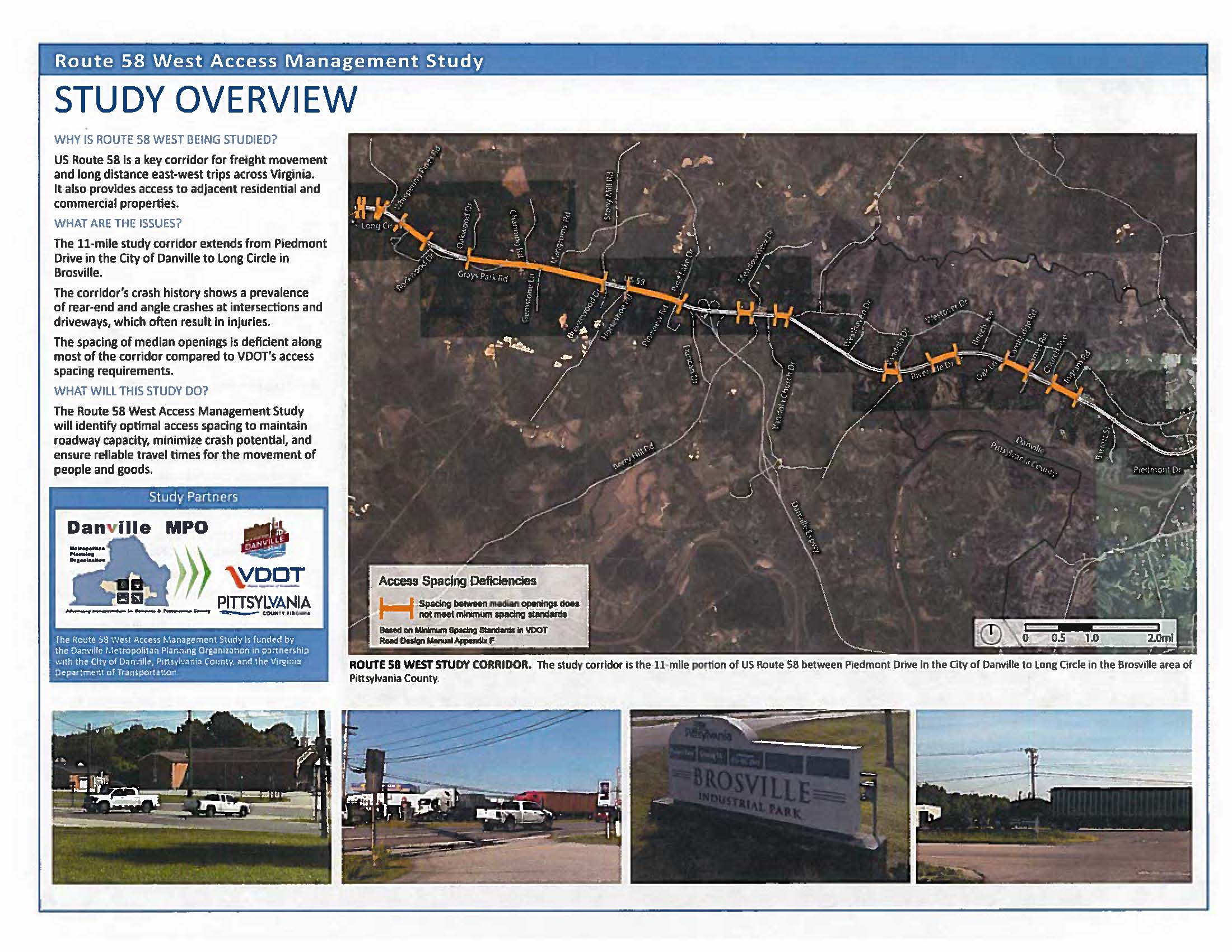
The Danville Metropolitan Planning Organization (MPO) has begun a study on an 11-mile segment of U.S. Route 58 in the City of Danville and Pittsylvania County to identify safety and functionality deficiencies along the length of the segment, as well as to provide recommendations thereunto. The MPO has contracted with EPR consultants of Charlottesville to conduct the study on the agency’s behalf; the Virginia Department of Transportation (VDOT) will also be heavily involved in the study.
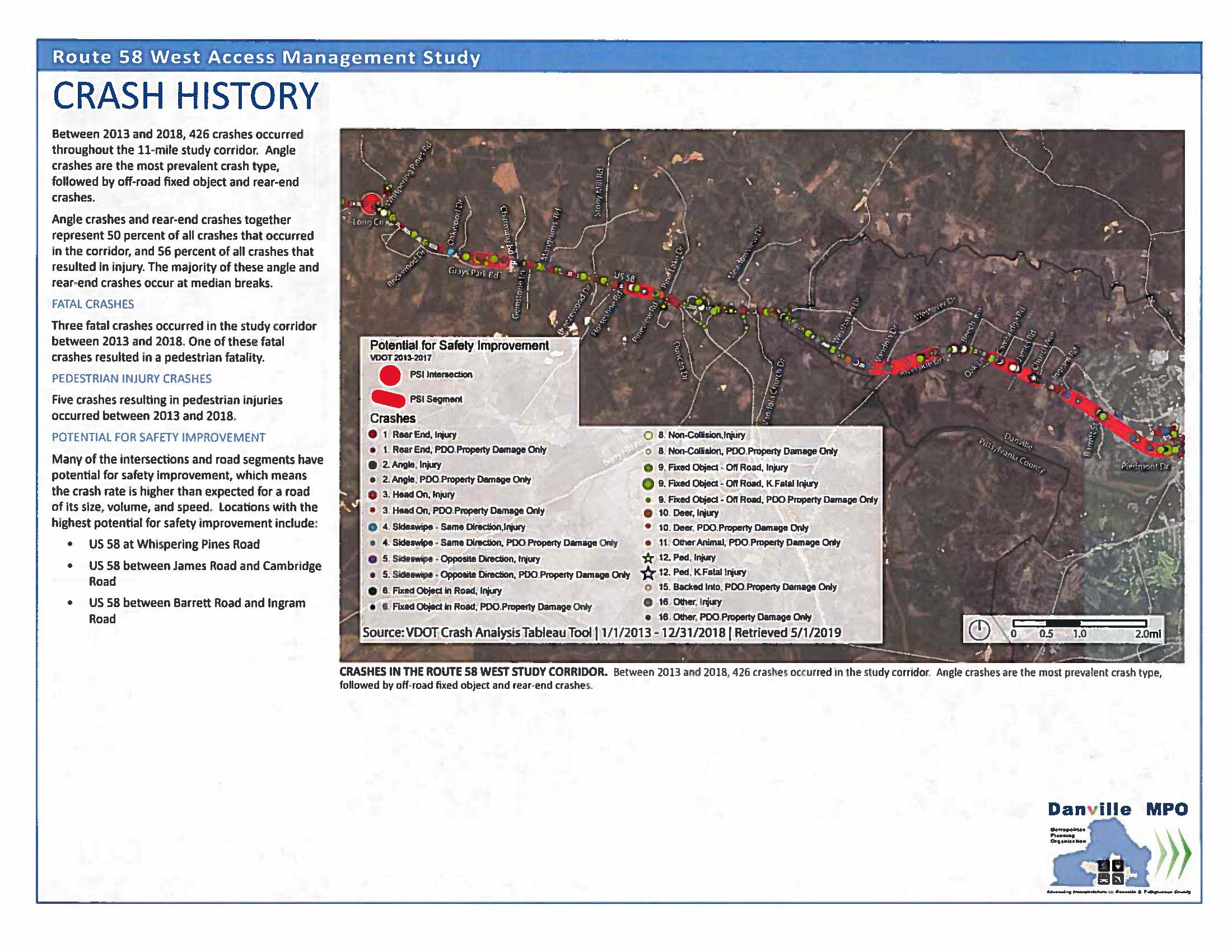
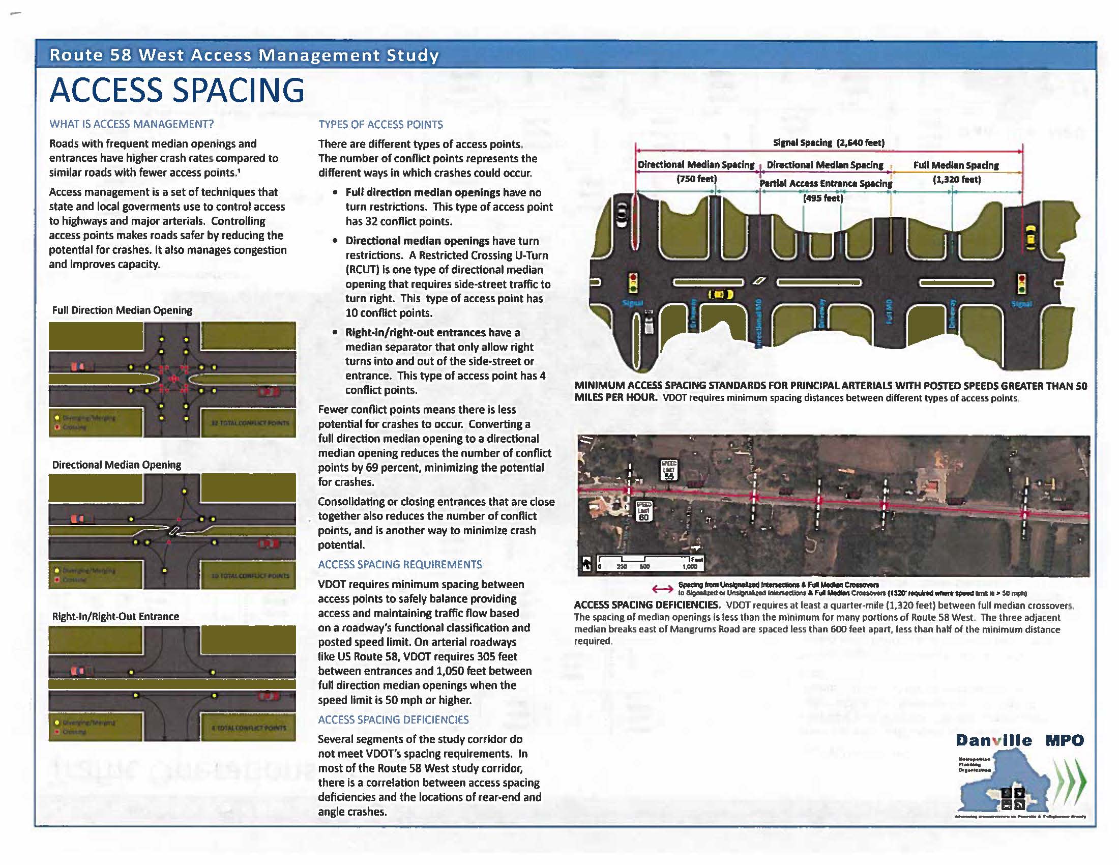
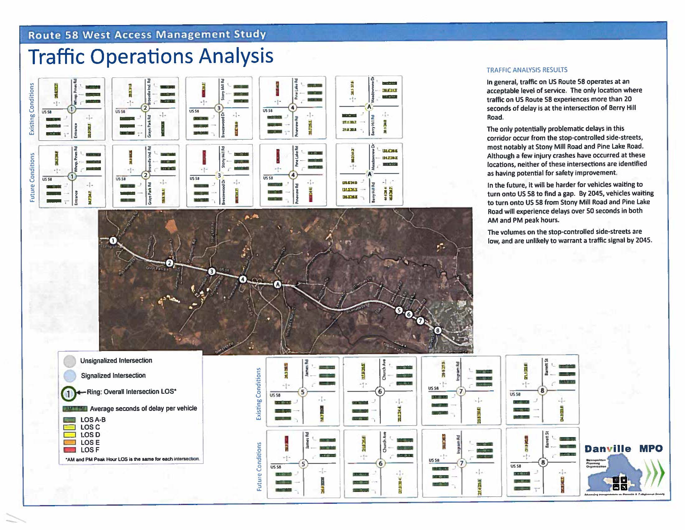
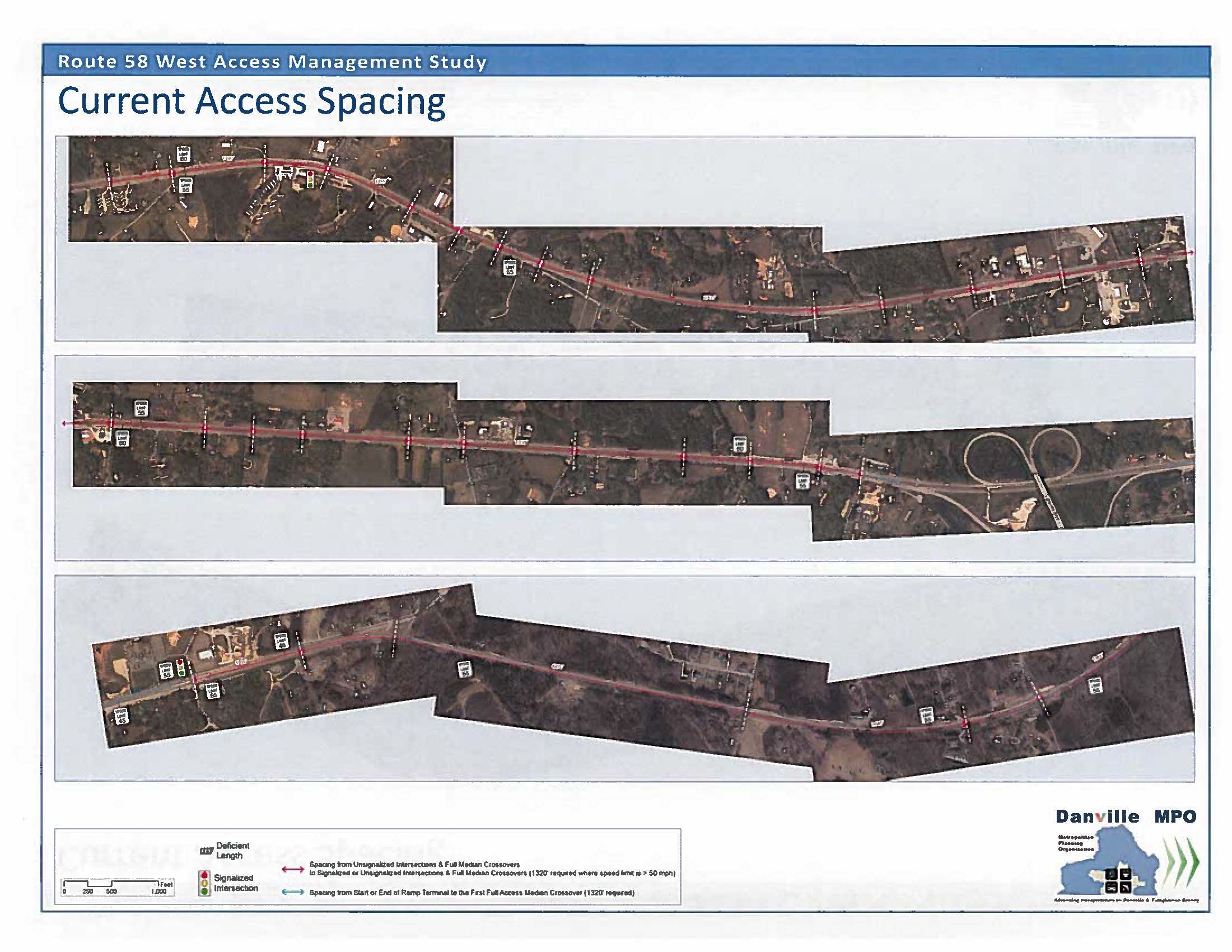
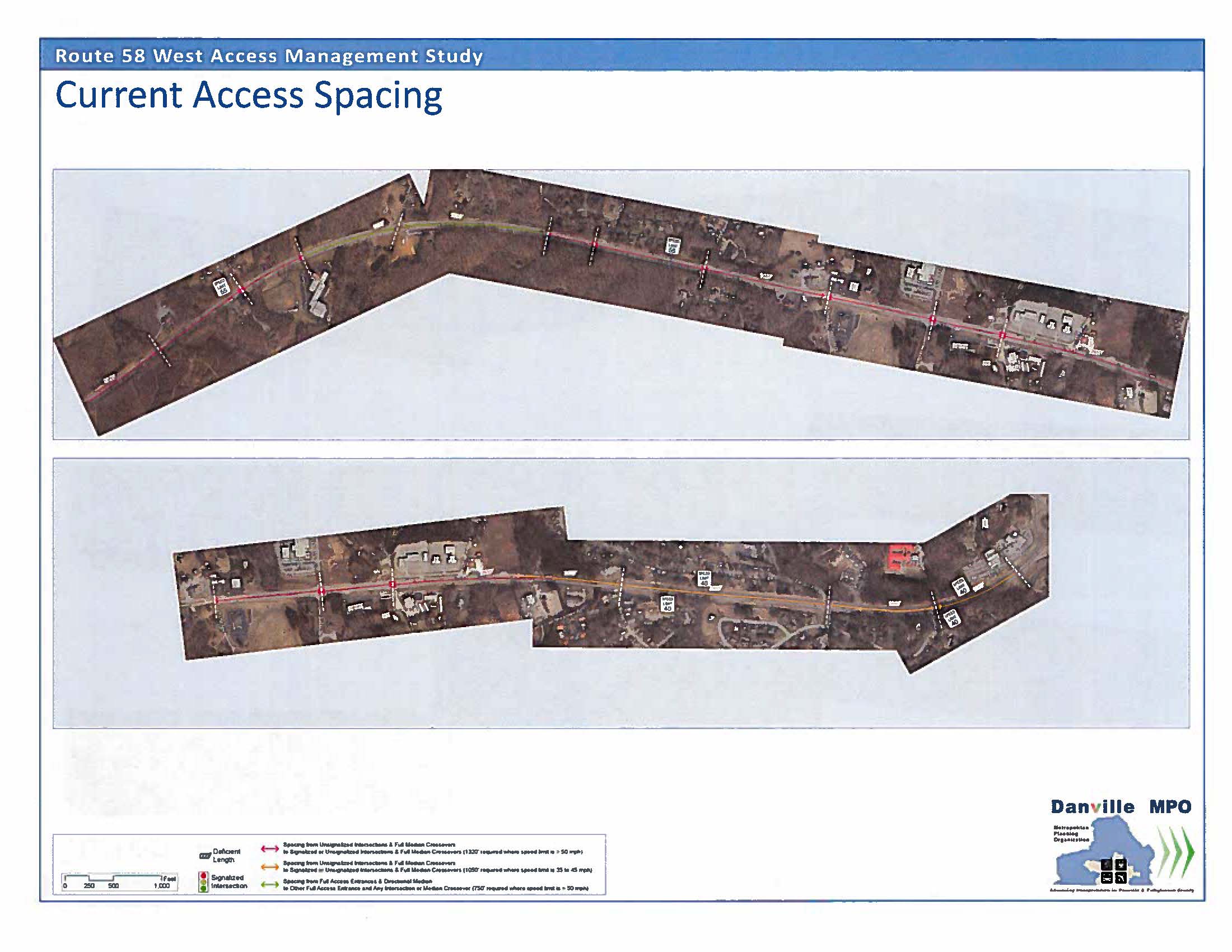
At this point, deficiencies and existing traffic conditions along the corridor have been identified. EPR noted deficiencies pertaining to median opening space requirements put forth by VDOT, crash data, as well as roadway level of service and vehicle delay at intersections. The consultant team also articulated previously-identified improvements along the corridor.
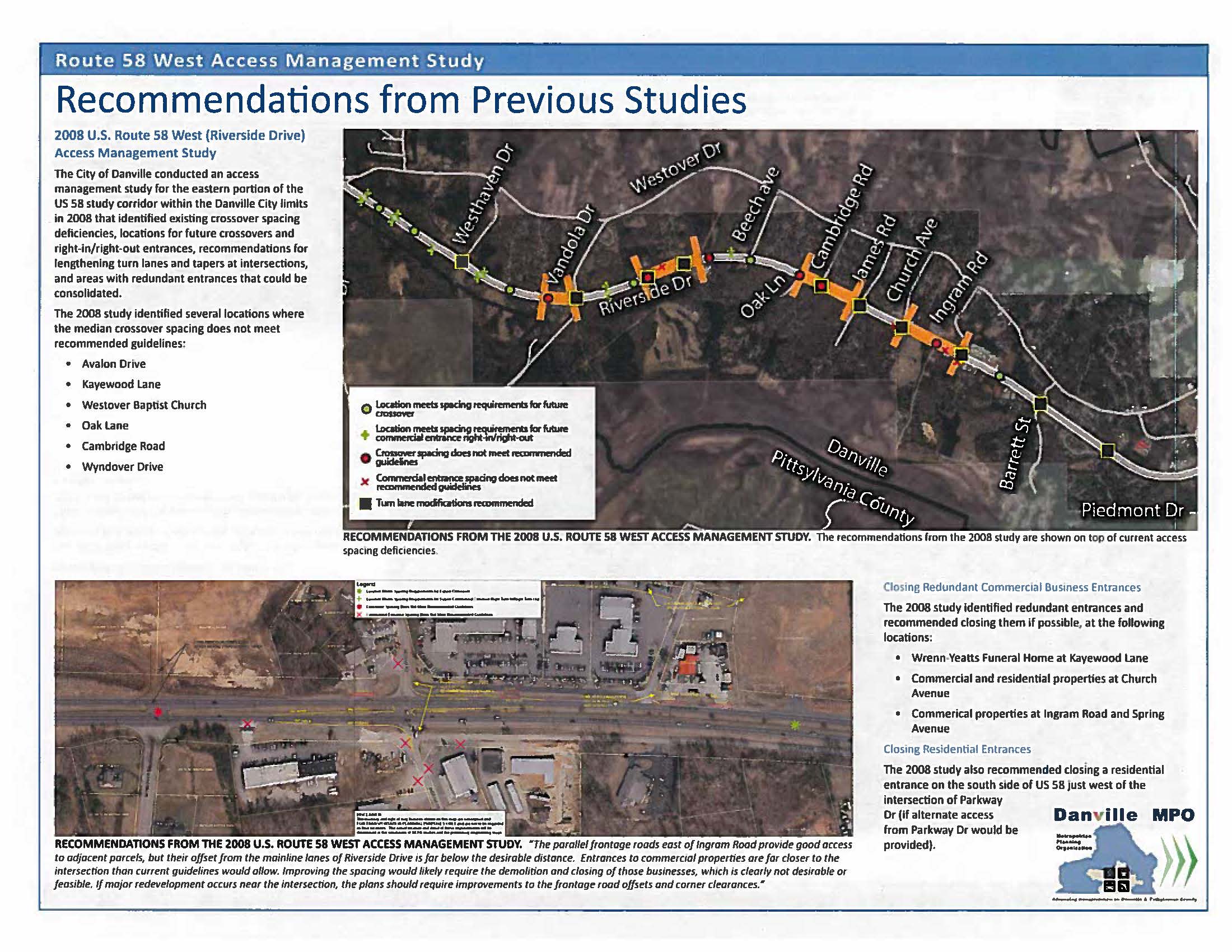
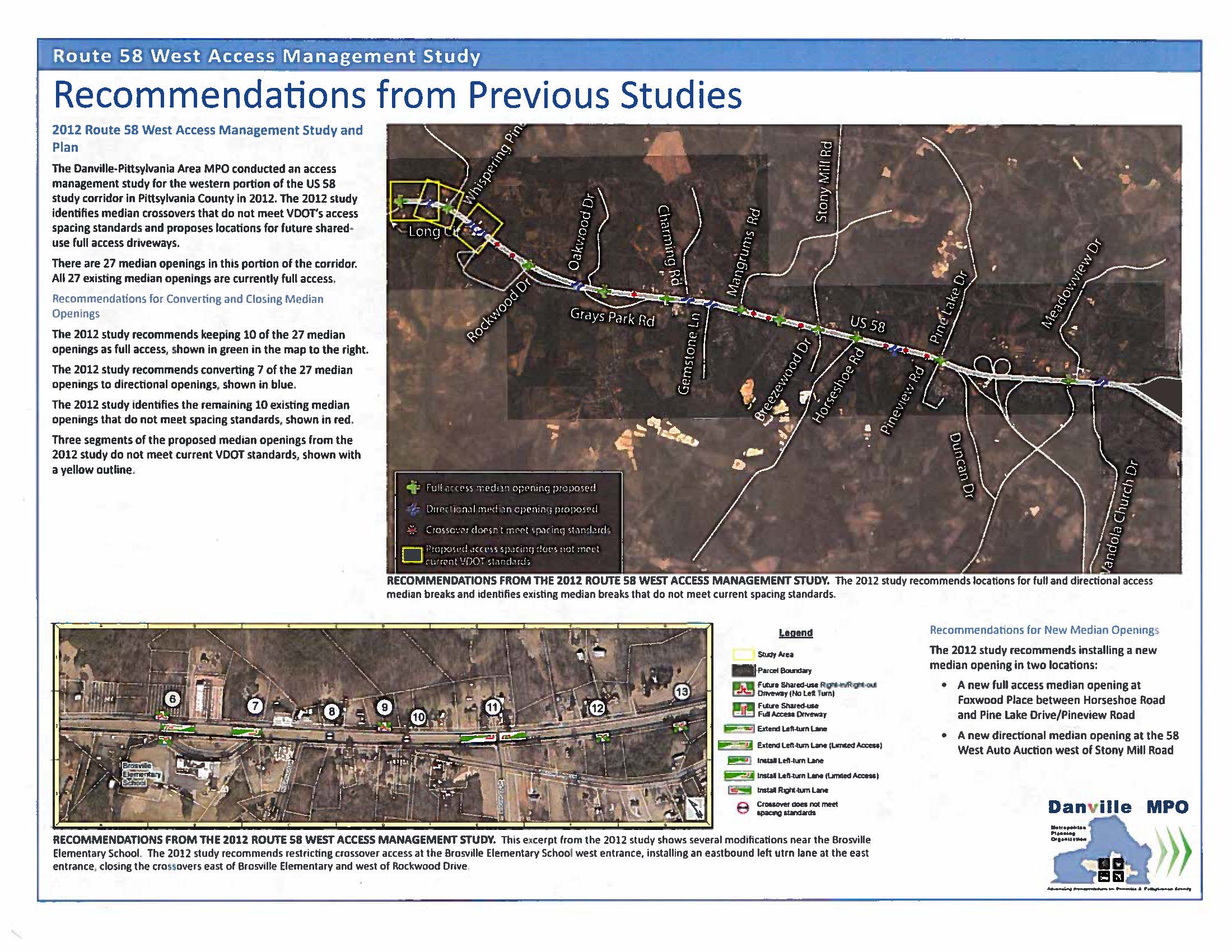
This study will serve as an update to the Route 58 West Access Management Study and Plan, adopted by the MPO in 2012. This original study extended from Long Circle in Pittsylvania County east to the Danville city limit – a distance of about 5.5 miles. Recommendations in that study included the closure of median openings that did not meet VDOT guidelines, access management techniques to combine access points, and the addition of turn lanes and directional median openings.
The decision was made to update the 2012 study because numerous developments have taken place and are occurring rendering such an action necessary. First, Smart Scale came into being several years ago, which radically changed transportation project funding by replacing a relatively arbitrary funding paradigm with a data-driven process. Second, over the last couple of years, VDOT began to embrace and promote innovative intersection designs which were not in wide use at the time of the original study. Third, the Southern Virginia Mega Site at Berry Hill – a 3,500 acre industrial park which will become a major regional employment center – is now primed for development, and one tenant has already announced plans to construct a facility at one of its sites. These factors, taken together, create a new dynamic for potential projects along the U.S. Route 58 corridor.
A major departure of this study, compared to the 2012 iteration, is that it will comprise a much longer segment of corridor. Rather than terminating at the city limit, the study area will extend more than five miles farther east to Piedmont Drive, encompassing a significant section of the City of Danville.
The study is anticipated to conclude in 2020, and comments on initial data gathering, noted above, as well as general need comments along the corridor, will be accepted until Friday, November 22nd. Please see the data exhibits shown below for preliminary information about the study. If you wish to comment, please direct comments to David Hoback, Executive Director of the West Piedmont Planning District Commission and Danville MPO Administrator, at dhoback@wppdc.org.